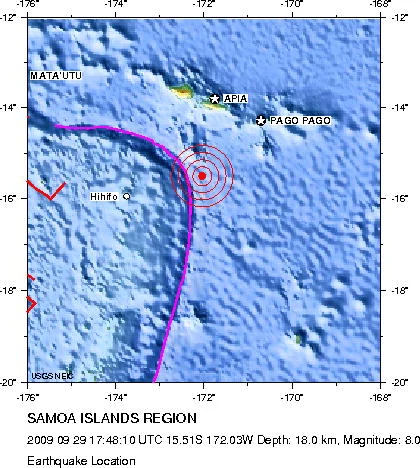
On September 29, 2009, a major tsunami struck the Samoa Islands region. According to the NOAA/NCEI Global Historical Tsunami Database, the event was triggered by an earthquake with a magnitude of 8.1. The seismic event occurred at coordinates -15.489 latitude and -172.095 longitude, at 17 hours, 48 minutes, and 10.9 seconds UTC on September 29, 2009.
Event Impacts and Measurements
The tsunami caused severe impacts across the affected area, registering a validity code of 4 in the historical record. The maximum recorded water height reached an extreme of 22.35 meters.
The disaster resulted in 192 deaths and 7 injuries. Total economic damage was evaluated at 285.0 million USD.
Frequently asked questions
When did the 2009 Samoa Islands tsunami happen?
The tsunami in the Samoa Islands occurred on September 29, 2009, at 17:48:10.9 UTC.
What caused the tsunami?
The tsunami was triggered by an earthquake with a magnitude of 8.1.
What was the maximum water height recorded during the event?
The maximum recorded water height reached 22.35 meters.
What were the reported casualties and economic impacts?
The event resulted in 192 deaths, 7 injuries, and 285.0 million USD in damages.
Image credits
- United States Geological Survey — Wikimedia Commons source — Public domain
Sources and further context
Official datasets support the event-specific facts.