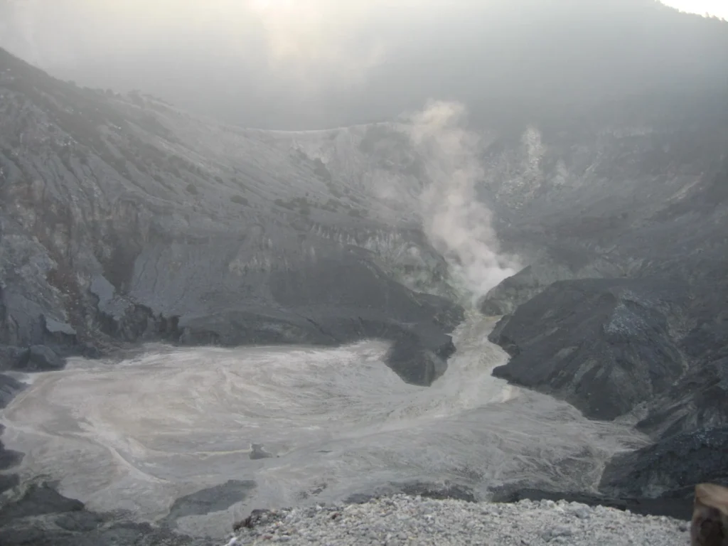
Tangkuban Parahu is a stratovolcano located in Indonesia, standing at an elevation of 2,084 meters within a subduction zone and continental crust setting exceeding 25 kilometers in thickness. Governed by the Smithsonian Global Volcanism Program's official records, the volcano has a confirmed total of 21 eruptions spanning from deep prehistory up to the 21st century.
The historical and prehistoric record shows activity categorized through various methods, ranging from uncalibrated radiocarbon dating for ancient events to direct human-reported observations for more recent centuries. Across its documented history, the volcano's recorded activity levels reached a maximum Volcanic Explosivity Index (VEI) of 2.0.
Overview of Recorded Eruptions
The 21 confirmed eruptions span multiple eras, beginning with an early event around 8020 BCE with an estimated start-year uncertainty of 50 years. The frequency of documented events increases significantly in more recent centuries, reflecting better observation and recording standards. According to the structured collection aggregates, the recorded eruptions are distributed across centuries as follows:
- 81st century BCE: 1 eruption
- 75th century BCE: 1 eruption
- 19th century CE: 5 eruptions
- 20th century CE: 11 eruptions
- 21st century CE: 3 eruptions
Chronological Examples of Activity
The official record details specific shifts in activity areas and observation methods over time. Early prehistoric activity, such as the event starting around 8020 BCE, was determined using uncalibrated carbon-14 isotopic evidence. Later events identify specific activity areas within the volcanic complex, such as Kawah Ratu B and Kawah Ecoma.
For instance, an eruption began at Kawah Ratu B on May 27, 1846, with a VEI of 2.0 based on reported observations. Another notable sequence at Kawah Ratu B spanned from April 7, 1910, to May 16, 1910, also registering a VEI of 2.0. Mid-20th-century activity included an eruption at Kawah Ecoma lasting from July 4 to July 11, 1952, with a VEI of 1.0. The latest confirmed eruption in the official record began on July 26, 2019, and ended on September 17, 2019, with a VEI of 1.0.
Understanding the Record and VEI
The Volcanic Explosivity Index (VEI) is a relative scale used to describe the size of explosive volcanic eruptions based on factors such as volume of products and cloud height. For Tangkuban Parahu, out of the 21 confirmed eruptions, 18 have associated VEI observations, with the largest recorded value being 2.0. The profile records the last known eruption year as 2019, with the latest confirmed eruption starting on July 26, 2019.
Frequently asked questions
Where is Tangkuban Parahu located?
Tangkuban Parahu is located in Indonesia.
How many eruptions has Tangkuban Parahu had?
The Smithsonian Global Volcanism Program records 21 confirmed eruptions for Tangkuban Parahu.
When was the last recorded eruption of Tangkuban Parahu?
The latest confirmed eruption in the official record started on July 26, 2019, and ended on September 17, 2019.
What is the largest recorded VEI for Tangkuban Parahu?
The largest recorded Volcanic Explosivity Index (VEI) for Tangkuban Parahu is 2.0.
Image credits
- JamesYoung8167 — Wikimedia Commons source — CC BY-SA 4.0
Sources and further context
Official datasets support the event-specific facts.