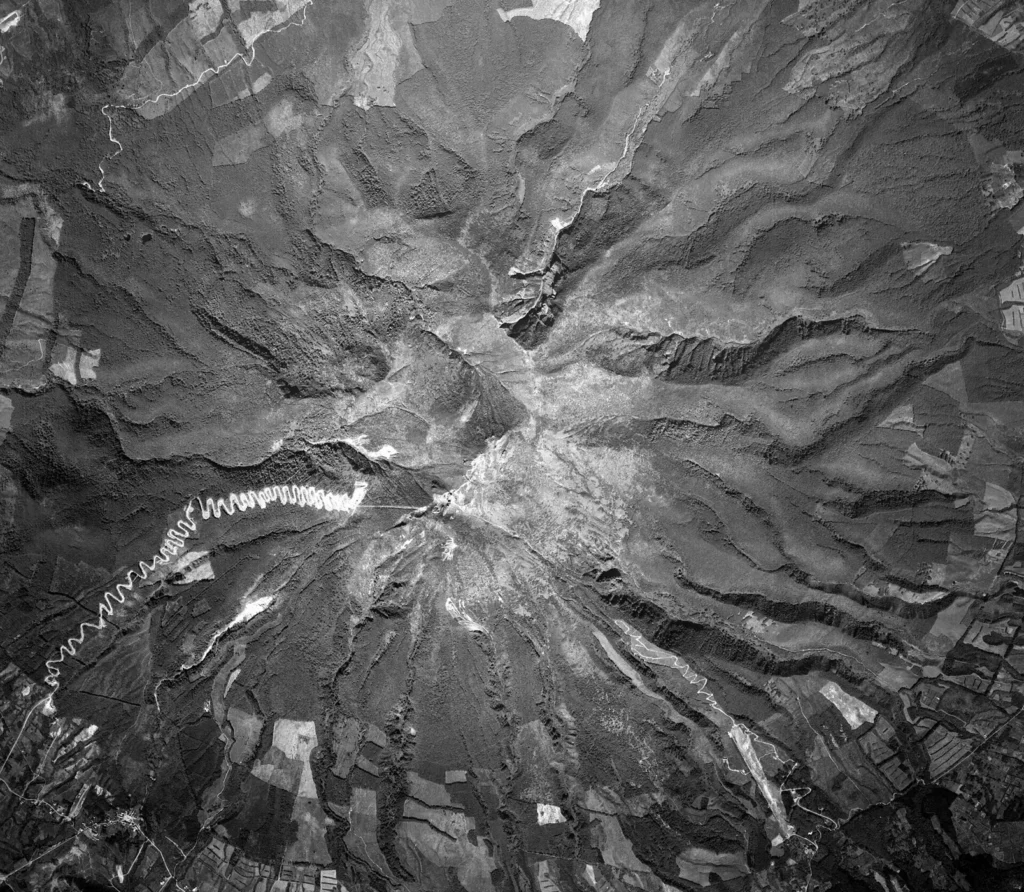
Geological Overview and Tectonic Context
Iwakisan is a stratovolcano located in Japan at geographic coordinates 40.656° N and 140.303° E. Reaching a summit elevation of 1,624 meters, the volcano lies in a subduction zone setting situated on continental crust with a thickness greater than 25 kilometers. The volcano is identified in the Smithsonian Institution's Global Volcanism Program database under volcano number 283270.
Chronology of Eruptive Activity
Data recorded by the Global Volcanism Program documents a total of 13 confirmed eruptions for Iwakisan. The eruptive history spans from prehistoric times through the late 19th century CE. The earliest documented eruption occurred around 8050 BCE, while the most recent confirmed event began on March 23, 1863 CE.
The distribution of confirmed eruptions across geological and historical periods includes the following breakdown by century:
- 81st century BCE: 1 eruption (~8050 BCE)
- 41st century BCE: 1 eruption
- 11th century BCE: 1 eruption
- 6th century BCE: 1 eruption (~550 BCE, with a date uncertainty of ±500 years)
- 16th century CE: 2 eruptions
- 17th century CE: 2 eruptions
- 18th century CE: 2 eruptions
- 19th century CE: 3 eruptions
Eruption Intensity and Representative Events
The explosive severity of volcanic events is categorized using the Volcanic Explosivity Index (VEI). Across Iwakisan's recorded history, VEI values have been assigned to 9 of the 13 confirmed eruptions. The maximum explosive strength recorded at Iwakisan reached VEI 3.0, observed during an eruption that began on February 7, 1604 CE.
Prehistoric activity at Iwakisan has been established primarily through physical dating methods, such as potassium-argon (K/Ar) isotopic dating and tephrochronology (the correlation of ash layers). In contrast, eruptions occurring from the 17th century CE onward were recorded through direct historical reports and human observations.
The table below provides a selection of representative eruptive records from the volcano's total collection of 13 confirmed events, detailing the activity area, start date, determination method, and assigned magnitude where available.
| Start Date / Era | Activity Area | Evidence Method | VEI Rating |
|---|---|---|---|
| ~8050 BCE | Torinoumi lava dome | Isotopic: K/Ar | Unassigned |
| ~550 BCE (±500 years) | Torinoumi lava dome | Correlation: Tephrochronology | Unassigned |
| February 7, 1604 CE | Torinoumi | Observations: Reported | 3.0 |
| October 9, 1790 CE | Not specified | Observations: Reported | 2.0 |
| March 23, 1863 CE | Not specified | Observations: Reported | 1.0 |
The last confirmed eruptive event on record occurred in 1863 CE, and no continuing or ongoing eruptive activity is indicated in the historical record since that date.
Frequently asked questions
What type of volcano is Iwakisan and where is it located?
Iwakisan is a stratovolcano located in Japan at latitude 40.656° N and longitude 140.303° E, standing at an elevation of 1,624 meters.
How many confirmed eruptions are on record for Iwakisan?
There are 13 confirmed eruptions recorded for Iwakisan in the Smithsonian Global Volcanism Program database.
When was the most recent confirmed eruption of Iwakisan?
The most recent confirmed eruption of Iwakisan began on March 23, 1863 CE.
What was the highest Volcanic Explosivity Index (VEI) recorded for Iwakisan?
The highest recorded eruption magnitude for Iwakisan was VEI 3.0, which occurred during the eruption that began on February 7, 1604 CE.
Image credits
- ContributorQ — Wikimedia Commons source — CC BY 4.0
Sources and further context
Official datasets support the event-specific facts.