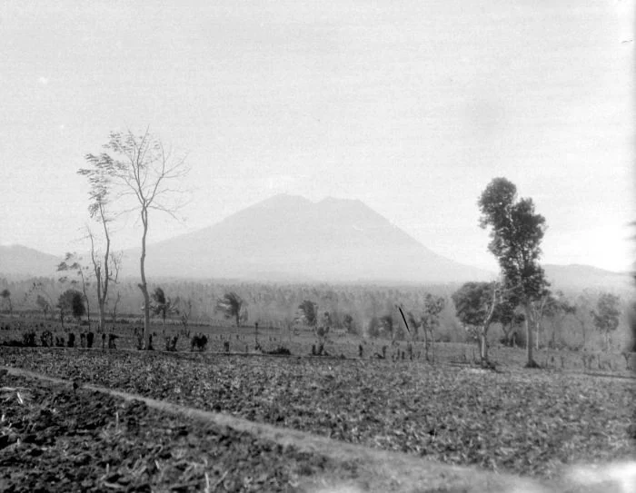
Lamongan is a stratovolcano located in Indonesia, standing at an elevation of 1,641 meters. Situated within a subduction zone and continental crust tectonic setting (greater than 25 km), the volcano has a structured historical record comprising 41 confirmed eruptions. Based on official records from the Smithsonian Global Volcanism Program, these events span a historical period from 1799 CE to 1898 CE.
Historical Eruption Record and Timeline
The documented eruptive history of Lamongan consists entirely of confirmed events recorded through observation. The earliest recorded eruption in the dataset began in 1799 CE with a Volcanic Explosivity Index (VEI) of 2.0. Historical activity continued across the 18th and 19th centuries CE, with the complete collection of 41 confirmed eruptions distributed across these two centuries: 1 eruption occurred in the 18th century CE, and 40 eruptions took place during the 19th century CE.
All 41 eruptions in the official record feature recorded Volcanic Explosivity Index (VEI) values. The largest recorded eruptions in the dataset reached a VEI of 3.0, such as the event spanning from April 24, 1877 CE, to May 12, 1877 CE. Other documented historical sequences include events with varied durations, such as an eruption in July 1838 CE (active from July 4, 1838 CE, to July 6, 1838 CE) and activity spanning mid-1864 CE (from June 9, 1864 CE, to July 16, 1864 CE).
Latest Recorded Activity
The final entry in Lamongan's confirmed eruption sequence took place on the southwestern flank at Mt. Anyar. This eruption began on February 5, 1898 CE, and concluded on February 15, 1898 CE, carrying a VEI of 2.0. The profile's last known eruption year is noted as 1898 CE, and the latest confirmed eruption date in the structured record is February 5, 1898 CE. The historical record indicates no subsequent confirmed eruptions following the 1898 CE activity.
Frequently asked questions
Where is Lamongan located?
Lamongan is a stratovolcano located in Indonesia, positioned at latitude -7.981 and longitude 113.341 with an elevation of 1,641 meters.
How many confirmed eruptions are recorded for Lamongan?
The official record documents 41 confirmed eruptions for Lamongan.
When did Lamongan's recorded eruptions take place?
Lamongan's recorded eruptions span from 1799 CE to 1898 CE, with 1 eruption in the 18th century CE and 40 eruptions in the 19th century CE.
What was the largest recorded VEI for Lamongan?
The largest recorded Volcanic Explosivity Index (VEI) for Lamongan is 3.0.
When did Lamongan's latest recorded eruption occur?
The latest confirmed eruption in the official record began on February 5, 1898 CE, and ended on February 15, 1898 CE, on the southwest flank at Mt. Anyar.
Image credits
- Dr. W.G.N. (Wicher Gosen Nicolaas) van der Sleen (Fotograaf/photographer). — Wikimedia Commons source — CC BY-SA 3.0
Sources and further context
Official datasets support the event-specific facts.