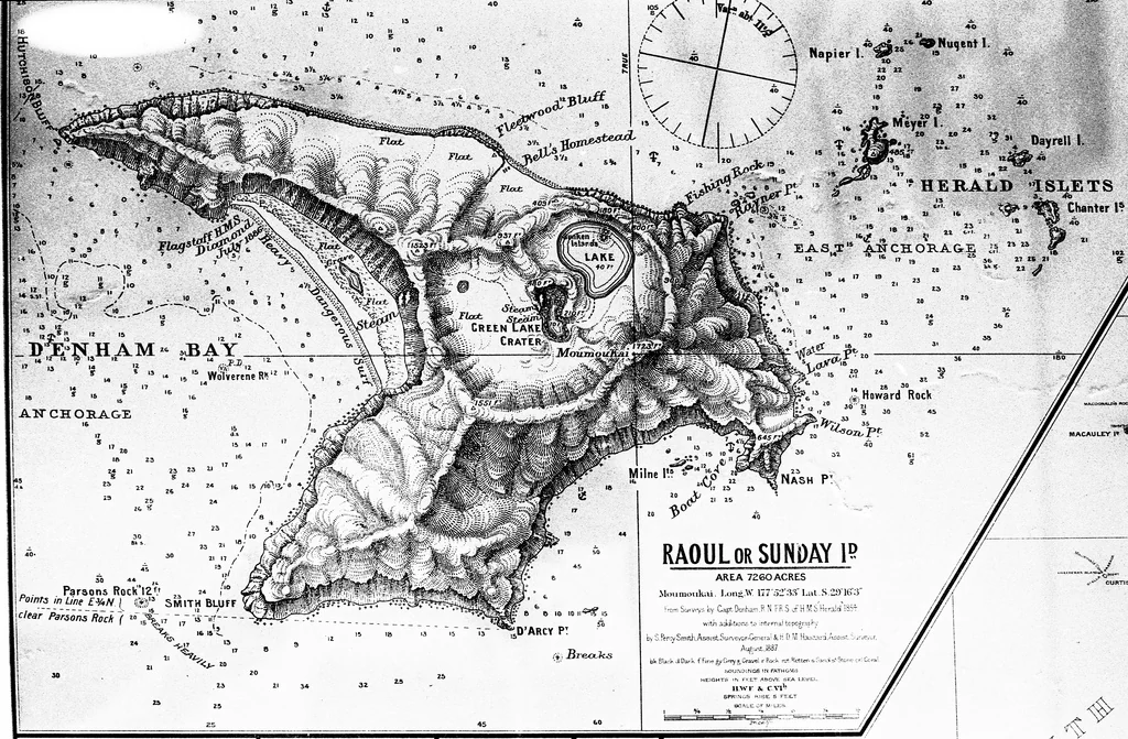
Raoul Island is a stratovolcano located in New Zealand within an oceanic crust subduction zone setting at a depth of less than 15 km, reaching an elevation of 516.0 meters. According to the Smithsonian Global Volcanism Program record, the volcano has 17 confirmed eruptions spanning from prehistoric isotopic records to 21st-century observations.
Overview of Eruption History
The confirmed eruption record for Raoul Island encompasses a wide chronological range, utilizing various evidence methods such as uncalibrated radiocarbon dating, tephrochronology correlation, and direct reported observations. Across the 17 confirmed eruptions, the Volcanic Explosivity Index (VEI) reaches a maximum recorded value of 6.0, observed during activity associated with the Denham caldera. Out of the total confirmed eruptions, 16 have recorded VEI classifications.
Historical and prehistoric activity spans multiple centuries across different areas of the volcanic complex, including the SE Raoul caldera, Denham caldera, the north flank of the Moumoukai volcano, Expedition Crater, and the Green Lake crater.
Chronology of Selected Recorded Eruptions
The structured record includes prehistoric events as well as more recent activity. Representative examples from the official record illustrate the variety of activity areas and evidence methods:
- 2000 BCE (approximate): Located at the SE Raoul caldera with an uncalibrated 14C isotopic evidence method and a VEI of 4.0 (with a start year uncertainty of 100 years).
- 250 BCE (approximate): Located at the Denham caldera with an uncalibrated 14C isotopic evidence method and a VEI of 6.0 (with a start year uncertainty of 75 years).
- 100 CE: Located on the north flank of the Moumoukai volcano, identified via tephrochronology correlation with a VEI of 4.0.
- 850 CE: Located at Expedition Crater, identified via tephrochronology correlation with a VEI of 4.0.
- 2006-03-17: Located at the Green Lake crater, documented through direct reported observations with a VEI of 1.0. This event marks the latest recorded eruption in the structured collection, concluding on March 17, 2006.
Frequently asked questions
How many confirmed eruptions does Raoul Island have?
Raoul Island has 17 confirmed eruptions recorded in the Smithsonian Global Volcanism Program database.
When did Raoul Island most recently erupt?
The earliest recorded eruption in the database dates back to 2000 BCE, and the latest recorded eruption occurred on March 17, 2006.
What is the largest recorded VEI for Raoul Island?
The highest recorded Volcanic Explosivity Index (VEI) for Raoul Island is 6.0, associated with activity at the Denham caldera.
Image credits
- not stated — Wikimedia Commons source — Public domain
Sources and further context
Official datasets support the event-specific facts.