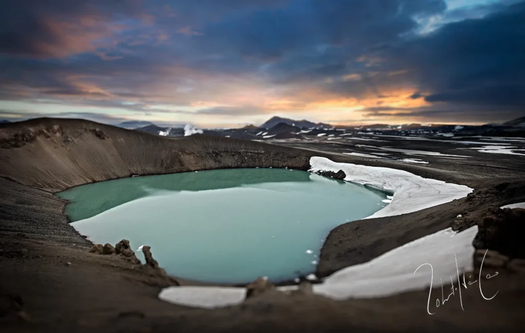
Krafla is a caldera volcano situated in a rift zone and oceanic crust of less than 15 kilometers depth in Iceland. Standing at an elevation of 800.0 meters with geographic coordinates 65.715° N and -16.728° W, the volcano has a recorded history of 23 confirmed eruptions. According to official records from the Smithsonian Global Volcanism Program, these events span from an earliest recorded year of -8500 (8500 BCE) up to its latest recorded eruption in 1984.
Overview of Recorded Activity and Explosivity
The Smithsonian Global Volcanism Program's structured record for Krafla contains 22 observations that include Volcanic Explosivity Index (VEI) values. Across these documented events, the largest recorded VEI is 4.0. The historical record distributes these 23 confirmed eruptions across multiple centuries, utilizing various evidence methods ranging from reported observations to tephrochronology correlations.
Historical Eruption Timeline by Century
Eruptions at Krafla have been documented across various epochs, stretching from ancient millennia through the modern era. The confirmed eruptions are distributed across the following centuries and periods:
- 31st century BCE: 1 eruption
- 69th century BCE: 1 eruption
- 68th century BCE: 1 eruption
- 65th century BCE: 1 eruption
- 85th century BCE: 1 eruption (starting around 8500 BCE with a modifier)
- 7th century BCE: 1 eruption
- 5th century BCE: 1 eruption
- 1st century BCE: 1 eruption
- 3rd century CE: 1 eruption
- 13th century CE: 1 eruption
- 18th century CE: 6 eruptions
- 20th century CE: 6 eruptions
Selected Historical Eruptions
The detailed records for Krafla illustrate diverse activity areas and observation methods over time:
- 8500 BCE: An early confirmed eruption occurred in the Gjastykkisbunga activity area, identified via tephrochronology correlation with a start year modifier.
- 650 BCE: An eruption reached a VEI of 4.0 in the Hverfjall and Jarbadsholar activity area.
- 500 BCE: An eruption occurred north of Hverfjall with an assigned start year uncertainty of 300 years and a VEI of 0.0.
- 1724 CE: A reported eruption took place from May 17, 1724, to May 18, 1724, in the Víti activity area (located 1.5 km east of Leirhnjúkur) with a VEI of 2.0.
- 1984 CE: The latest recorded eruption occurred from September 4, 1984, to September 18, 1984, spanning from Leirhnjúkur to 8.5 km north, with a VEI of 0.0.
Frequently asked questions
How many confirmed eruptions does Krafla have?
Krafla has 23 confirmed eruptions listed in the official Smithsonian Global Volcanism Program record.
When was Krafla's latest recorded eruption?
Krafla's latest recorded eruption took place from September 4 to September 18, 1984.
What is the highest Volcanic Explosivity Index (VEI) recorded for Krafla?
The largest recorded VEI for Krafla is 4.0.
Where is Krafla located?
Krafla is located in Iceland at 65.715° N, -16.728° W, within a rift zone and oceanic crust setting at an elevation of 800.0 meters.
Image credits
- Roberto Iván Cano — Wikimedia Commons source — CC BY 3.0
Sources and further context
Official datasets support the event-specific facts.