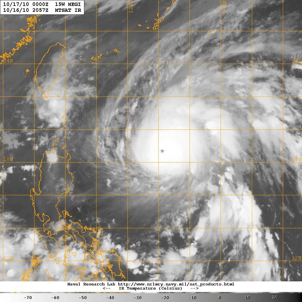
Megi (2010) was a tropical cyclone tracked in the Western North Pacific basin during October 2010. According to official historical records from the NOAA/NCEI International Best Track Archive for Climate Stewardship (IBTrACS) v04r01, the system was monitored across a total of 103 track points from its start date on October 11, 2010, at 12:00:00 UTC through its final recorded track point on October 24, 2010, at 06:00:00 UTC. The official data collection for this event is designated with the system ID 2010285N13145 and subbasin code MM, with analytical input provided by the World Meteorological Organization (WMO) responsible agency in Tokyo.
Intensity and Pressure Measurements
Intensity metrics for Megi are established using data from the WMO responsible agency. The system reached a maximum sustained wind speed of 125.0 knots (approximately 231.5 kilometers per hour). In terms of barometric pressure, the storm recorded a minimum pressure of 885.0 millibars. These values reflect the peak intensity captured within the official structured record period ending on October 24, 2010.
Track Summary and Progression
During its 103-point trajectory across the Western North Pacific basin, Megi spanned a mean track latitude of 17.35 degrees and a mean track longitude of 127.42 degrees. The historical path moved across various coordinates over a period of nearly two weeks. Representative milestones from the official track record illustrate its progression:
- October 11, 2010, at 12:00:00 UTC: Initial record at latitude 12.7, longitude 145.0.
- October 14, 2010, at 18:00:00 UTC: Positioned at latitude 13.6, longitude 137.9.
- October 17, 2010, at 21:00:00 UTC: Positioned at latitude 17.5, longitude 123.8.
- October 21, 2010, at 00:00:00 UTC: Positioned at latitude 19.4, longitude 117.5.
- October 24, 2010, at 06:00:00 UTC: Final recorded track point at latitude 26.2, longitude 118.5.
The complete dataset comprises 103 individual observations detailing the movement and behavior of the system throughout its active lifespan in the 2010 season.
Frequently asked questions
When did Megi (2010) occur?
Megi was active in October 2010, with official track records spanning from October 11, 2010, at 12:00:00 UTC to October 24, 2010, at 06:00:00 UTC.
What was the maximum intensity of Megi (2010)?
According to the WMO responsible agency data in IBTrACS, Megi reached a maximum sustained wind speed of 125.0 knots (231.5 km/h) and a minimum pressure of 885.0 millibars.
Where was Megi tracked?
The official tracking data was recorded in the Western North Pacific basin (subbasin MM) using analytical input from the WMO responsible agency in Tokyo.
Image credits
- NRL — Wikimedia Commons source — Public domain
Sources and further context
Official datasets support the event-specific facts.